Om turen
( Information in English? Look below the Norwegian information )
Skildring av tur
Ved skihuset i Krossdalen er det skilta til Flatabøgryting, og du følgjer lysløypa ca 0,5 km. Ved eit retningsskilt tar du av frå lysløypa og inn i litt myrlendt skogsterreng. Når terrenget etterkvart vert brattare må du over Gjetingselva og vidare i bratt, men god sti til du kjem over skoggrensa. Du kjem til Kvålsbotn og går i fint fjellterreng i denne opne dalen og så litt opp og forbi Skardtjørna. Når du kjem på høgste punktet ser du ned på Grytingsvatnet og stølen Flatabøgryting. Stien er merka vidare langs vestsida av Grytingsvatnet til stikryss, der du kan gå til venstre mot Hestadalen eller til høgre mot Breidsete.
Råd for turen
-Ta med mat, drikke og vindtette klede.
- Du bør ha fjellstøvlar, men har det vore tørt ei stund kan du bruke joggesko.
- Mobildekning er ikkje god på heile turen.
- Vi anbefaler kart og kompass, ev. GPS.
- Det er bandtvang 1. april – 20. august.
- Det er forbode med open eld i skog og mark 15. april - 15. september.
- Til fots kan du ferdast fritt i utmark, men ver varsam og ta omsyn til dyr og fuglar, og til naturen elles. Ikkje kast søppel.
- Fiskekort for dette vassdraget er å få kjøpt i Coop-butikken.
English version:
Starting point/parking
Take the road from Jondal towards Folgefonna. After 8.0 km turn right just before the bridge. (Close to the road junction is an information board showing details of several tours).
After 2.0 km take a right turn. The short road ends at a ski arena, where there’s a good car park by the club house. Parking at own risk.
Description of the hike
The hiking sign marking the route to Flatabøgryting is close to the club house. The first 0.5 km follows the lighted ski track. The route moves away from the ski arena at a new hiking marker and crosses a marshy woodland area. The path moves uphill, and then across the river, Gjetingselva (by hopping stones). The hike is now on a steep but good track through the woods and up to the tree line. Above the tree line and over the shoulder you reach a good mountain terrain in the open valley at Kvålsbotn. Continue up the hill at the end of the valley and past the little lake, Skardtjørna. At the highest point of the trail, you can view the lake, Grytingsvatnet and the mountain cabins of Flatabøgryting. The hike is marked following the west side of Grytingsvatnet until it arrives to a connecting point with another tour.
Season
June – October/November.
Hiking advice
Bring food, drinking water and windproof clothing.
We advise you to use hiking boots. If it’s been dry weather for a while, you could use trainers/sneakers.
We recommend that you bring a map of the area and a compass, or a GPS.
Cell phone signals are NOT GOOD during the whole of this hike.
Dogs must be always kept (by law) on a leash between April 1 and August 20.
Open fire is prohibited in the hills and woods between April 15 and September 15.
You are free to walk anywhere in the hills and mountains. Take care of the nature and show special consideration to all wildlife. Please do not litter.
Fishing licence for these lakes can be bought at the Coop shop.
Slik kommer du deg dit
- Adkomst
- Stoppesteder
- Google Maps
Adkomst med egen bil
Ta vegen frå Jondal mot Folgefonna. Etter 8,0 km tar du til høgre mot Folgefonna. Like etter krysset er det på høgre sida av vegen ei infotavle for turane i området. Etter 2,0 km tar du opp til høgre; ein kort veg som endar ved skihuset på Storemyr. Der er det ein god parkeringsplass. Parkering på eige ansvar.
on the path
Kolofon
UT.no er en tjeneste fra Den Norske Turistforening, i samarbeid med Statskog, Friluftsrådenes Landsforbund, Miljødirektoratet og Kartverket.
Med støtte fra Sparebankstiftelsen DNB.
Takk til alle som bidrar med turforslag, hytter, steder og annet innhold på UT.no!
Finn din tur blant tusenvis av turforslag og hytter i hele Norge
Fellesturer, kurs og aktiviteter
Er du en fersking? Eller har du lyst til å dra på tur med andre? DNT arrangerer fellesturer, kurs og aktiviteter over hele landet!
Se oversikt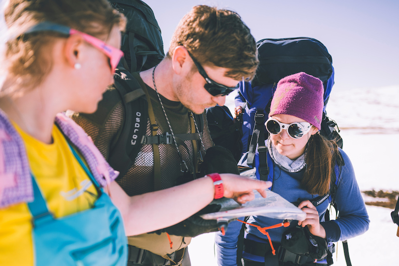
Nytt turutstyr eller kart?
Trenger du turutstyr eller kart til turen? DNTs nettbutikk har godt utvalg av turkart for hele landet, samt turutstyr til medlemspriser.
Se dntbutikken.noOpphavsrett, der ikke annet er angitt, Den Norske Turistforening © 2024
Versjon: 1510759